GO this morning, with a hard early-out. This is a launch-now, fish-the-morning, off-by-1-PM day. Right now it is glass: the marine zone calls SW 5-10 kt becoming west with waves 1 ft or less, and SW is the lee quadrant at Catawba, the friendliest wind this brief ever reports. The buoy backs it: water 76.1°F, the full-summer number, wind a light SE 11.7 kt at the 7:10 AM read. The board is clean this morning: no Small Craft Advisory, no fog advisory, no thunderstorm watch yet. The whole plan hinges on this afternoon. The NWS point forecast has an 80% chance of showers and thunderstorms mainly after 3 PM, and tonight the wind clocks NW 10-15 kt increasing to 15-20 kt with waves building to 1-3 ft and waterspouts possible. NW is the worst direction for the Fish Pro, it stacks chop straight onto the shallow reefs. Sunday is worse still: NW 15-20 kt, waves 2-4 ft, a textbook Western Basin NO-GO. So today is not one good morning among several, it is the only safe window this weekend. The bite is perch. At 76°F, late July through August is prime yellow-perch season and the Catawba area is a classic perch spot, deepwater near the reefs in 28-32 ft, spreaders with emerald shiners on the bottom. Walleye are a first-light reef bonus, morning bite on the reef edges before they scatter deeper. Because the storms come from the W/NW and the legs home need to be short, the whole top three sits close to the ramp today, biased toward Mouse Island and the Catawba deep flats. Fish it hard now, keep one eye on the western sky, and be on the trailer before the sky decides.
> TOP SPOTS TODAY · coords + how to fish them · biased close, because the storms come from the W/NW and short legs home are the whole point today
RANK 01 · CLOSEST · PERCH + WALLEYE + YOUR WAVE GAUGE
Mouse Island REEF
HIGH CONFIDENCE
N 41° 36.402'
W 82° 49.962'
~1.2 nm NNE of launch · 9-22 FOW
Closest structure to home, and on a day built around beating storms in, it is the obvious first and last stop. Two-minute run back if a cell builds. Fish it two ways. Walleye at first light: work the 14-22 ft rock edges, vertical-jig a 3/8-1/2 oz hair jig with a stinger, or run a Husky Jerk 40 ft back at 1.5-1.7 mph to find pods, then jig through anything you stack. Perch as the sun climbs: slide off the reef to the deeper breaks (20+ ft), two-hook spreader with emerald shiners on any school you mark. This reef is also your wave gauge, run the 1.2 nm, look at the water, and let that decide whether you go any farther out.
RANK 02 · THE PERCH PLAY · CLOSE + PROTECTED ON A SW WIND
Catawba Deep Flats (NE)
MED CONFIDENCE
N 41° 37.600'
W 82° 48.500'
~2-3 nm NE · 28-32 FOW · perch program
The late-August money bite off Catawba. At 76°F the yellow perch are stacked in the deep water NE of the island over the mud-to-rock transitions, and this is the classic spot anglers target this time of year. Doubles and triples are normal when you are on a school. Fish it simply: idle the 28-32 ft contour watching the finder, and when you mark fish, anchor and park on the school rather than drifting through it. Two-hook perch spreader, #4-6 hooks, fresh emerald shiners pinned to the bottom, lift a foot and hold. This water sits protected on today's SW wind with Catawba upwind. West Zone limit is 30. Move if you don't mark or catch in 10 minutes, perch are schooled and mobile.
RANK 03 · BETTER WALLEYE · BUT INTO THE WEATHER — FAIR SKY ONLY
Round / Niagara Reef
HIGH CONFIDENCE
N 41° 37.040'
W 82° 59.150'
~6.7-7 nm W/NW · 10-22 FOW · walleye reef edges
The better walleye water, but it is 6-7 nm out to the W/NW, which is exactly the direction the storms and the afternoon NW blow are coming from. Only run out here if the western sky is dead clean and you commit to turning back early, this is a 25-minute leg home if a cell builds. Fish the 18-22 ft reef edges: troll crawler harnesses behind a 1-2 oz bottom bouncer at 1.0-1.2 mph, or vertical-jig the rocky outskirts. Round and Niagara sit next to each other, so work them as one complex on a single trip out. On a day like today I would keep it close and treat this as a dawn-only option.
⬇ DOWNLOAD ALL WAYPOINTS (.GPX)
Full list (launch + fishing spots) in section 03 below.
Water Temp
76.1°F
Buoy 45005, 7:10 AM ET · FULL SUMMER · PERCH PRIME
Wind
SW 5-10 kt
AM, LEE QUADRANT · CLOCKS NW 15-20 TONIGHT
Waves
≤1 ft
AM per LEZ143 · BUILDING 1-3 FT TONIGHT
Air Hi/Lo
79 / 61
80% STORMS AFTER 3 PM · WATERSPOUTS POSSIBLE
01Jet-Ski Call — CAUTION: GO this morning, off by 1 PM NWS LEZ143 + Ottawa County point forecast + buoy 45005 pulled 7:40 AM ET 8/22 · live data on refresh
Right now is the best water you will see all weekend, and it does not last. The marine zone calls this morning SW 5-10 kt becoming west with waves 1 ft or less. On a shallow basin that is about as calm as Catawba gets, and the SW direction keeps the south shore in the lee. The board is clean as of the morning read: no Small Craft Advisory, no fog advisory, no thunderstorm watch posted yet. The buoy shows water at 76.1°F and a light SE 11.7 kt at 7:10 AM.
Direction is the best part of the morning. Southwest is the lee quadrant at Catawba. The land sits upwind, fetch at the launch is close to nothing, and the shallow north reefs, the ones that turn ugly on a north wind, are protected. That is the friendliest wind direction this brief ever gets to report, and it is why the morning launches clean.
The whole plan hinges on the afternoon, and the afternoon is bad. The NWS point forecast has an 80% chance of showers and thunderstorms mainly after 3 PM, with a quarter to half inch of rain. Tonight the wind clocks NW 10-15 kt increasing to 15-20 kt, waves build to 1-3 ft, and the marine zone notes waterspouts possible. NW is the worst direction for the Fish Pro because it piles chop straight onto the shallow reefs. Sunday is worse: NW 15-20 kt with waves 2-4 ft, a straight NO-GO. So this morning is not one good window among several. It is the only one this weekend.
The clock is the constraint, not the water. Launch now, fish through early afternoon, and set yourself a turnaround before you leave the ramp. Go-home triggers today: any thunder, any tower building to your west, or the wind swinging NW and the chop stacking on the reefs. Do not wait for the first raindrop. On a PWC with pop-up storms forecast, you want to be on the trailer before the sky decides. A cell that is an inconvenience in a boat with a cabin is a different problem entirely on a jet ski.
Launch Catawba Point. Bail-out harbors: Catawba, Port Clinton, Put-in-Bay, Kelleys.
Keep the legs short today
The TOP SPOTS panel is biased close on purpose. Mouse Island Reef is 1.2 nm and the Catawba deep flats are 2-3 nm, each a short run back to the ramp. Round and Niagara at 6.7-7 nm are the better walleye water, but they sit W/NW, exactly the direction the storms and the afternoon blow are coming from. On a day with an 80% afternoon storm risk, treat the western reefs as dawn-only and be honest about the run home. When in doubt, stay close.
Mouse Island Reef is your wave gauge
The 1 ft figure is the morning marine-zone call, not a buoy wave measurement (45005's WVHT channel is frequently dark). Run the 1.2 nm to Mouse Island Reef first, look at the actual water, and let that decide how far out you are willing to go. An estimate is not an observation, and the wind is only going to build from here.
Sunday is a NO-GO, and this afternoon is the turn
Tonight goes NW 10-15 kt increasing to 15-20 kt with showers and thunderstorms and waterspouts possible, waves building to 1-3 ft. Sunday is NW 15-20 kt with waves 2-4 ft subsiding to 1-3 ft. That combination, north quadrant plus 15-plus knots plus 2-4 ft over shallow water, is the exact set of conditions the Fish Pro's envelope says stay home for. Do not plan a Sunday trip. Treat this morning as the window you had.
02What's Biting community.walleye.com index + regional Aug 2026 reports + seasonal pattern · pulled 7:40 AM ET 8/22
- Yellow perch — the headline bite right now. Late July through August is prime perch season on the Western Basin, and the Catawba Island area is a classic perch spot. The two newest threads on community.walleye.com are perch ("Perch" 8/20, "Fishing with Rick and Donna" 8/19). At 76°F the fish are in the deepwater near the reefs, 28-32 ft, over mud-to-rock transitions. Two-hook spreader, #4-6 hooks, emerald shiners pinned to the bottom, straight down on any school you mark. When you find one you find a lot of them, doubles and triples are normal in August. West Zone limit is 30 per angler. Anchor and park on the school, don't drift through it.
- Walleye — off the reef spawn and into the summer program. Morning bite on the reef edges (Mouse Island, Niagara, Round, Toussaint) in 24-30 FOW, then fish scatter into open water as the sun climbs, with some pushing east toward the islands and the Canadian line. Troll crawler/worm harnesses behind a 1-2 oz bottom bouncer at 1.0-1.2 mph, or crankbaits at 1.5-1.8 mph. Chartreuse/gold and purple blades are Western Basin staples. First light is your best walleye window today, so if walleye is the target, be on a reef edge at launch.
- Smallmouth bass: Dialed in at 76°F, holding on rocky points and reef edges around the Bass Islands and the island shoals. Tubes, drop-shot, jerkbaits on the bottom. A solid backup if the walleye lock up at midday.
- White bass / sheepshead: Roaming the basin and will hit harnesses and jigs. Summer surface blitzes possible any day at this temperature, keep a small spoon rigged for boils. Fun on light tackle if you run into a school.
02bRecent Angler Reports (Facebook) loading...
02cWater Clarity (NASA MODIS satellite) NASA Worldview · 250 m/pixel · today's pass
Two satellites pass over Lake Erie daily. Use these to spot sediment plumes (muddy west end from Maumee River runoff), algae blooms (green/turquoise patches), and clearer water (deep blue). Walleye prefer stained but not muddy water — pick areas where the plume is fading into clearer blue.

TERRA · ~10:30 AM EDT pass · click for interactive

AQUA · ~1:30 PM EDT pass · click for interactive
Reading the imagery
White: clouds. Light tan / brown: heavy sediment (skip). Turquoise / green: algae or stained (often productive walleye). Deep blue: clear (smallmouth water). Plume edges where muddy meets clear = the walleye sweet spot. Two things to expect on today's frames. First, cloud cover is likely — storms move in this afternoon, so the Aqua ~1:30 PM pass may be largely white and the morning Terra pass has the better odds today. Second, the water is at 76°F, peak season for the western basin's cyanobacteria bloom. A green tint at the west end near Maumee Bay is far more likely algae than sediment. That matters for where you fish: heavy bloom water is worth steering around, while the stained-to-clear transition is what you want. Match the picture to the intel — perch in the Catawba deep flats, walleye on the reef edges and east toward Kelleys.
If clouded over, step back a day in the Worldview interactive viewer.
03Where to Go (full list) static for the day
⬇ DOWNLOAD .GPX FOR GARMIN
ON THE WATER » PHONE → FISH FINDER (3 TAPS)
One-time setup: Install Garmin ActiveCaptain on phone, enable Wi-Fi on ECHOMAP (
Settings » Communications » ActiveCaptain), pair.
On the water: open
reel.quest/today → tap DOWNLOAD GPX → iOS share sheet → ActiveCaptain → waypoints sync wirelessly.
CONFIDENCE LEGEND
[HIGH] verified from authoritative source.
[MED] center-of-feature only; fish on edges.
[LOW] guess from satellite or vague intel. Always: waypoint is starting point. Fish hold on drop-offs and current breaks, 50-200 yards off the named coord.
Read the list in two halves today. Spots 2 and 3 are inside 3 nm and are what this brief actually recommends, because the afternoon storm risk means short legs home are worth more than distance. Spots 4 through 10 are fishable on this morning's calm SW wind but sit W/NW toward the incoming weather, so they are dawn-departure-only and you commit to turning back early.
- Catawba Point Association ramp (launch). [LOW] Your home ramp. Drop a pin at actual ramp and tell me — I'll re-deploy.
> N 41° 35.280', W 82° 50.400'
📍 Open in Maps
- Mouse Island REEF. [HIGH — Natural Atlas] Actual fishing structure, NOT the island. ~1.2 nm NNE of launch. Limestone shoal, 0.33 sq mi, least depth 9 ft. RANK 01 today, and it has two jobs. First it is your wave gauge: run the 1.2 nm and look at the water before committing to any longer leg. Second it fishes two species: walleye at first light on the 14-22 ft rock edges (hair jig or Husky Jerk 40 ft back at 1.5-1.7 mph to find pods), then perch on the deeper 20+ ft breaks as the sun climbs, two-hook spreader with shiners on any school you mark.
> N 41° 36.402', W 82° 49.962'
📍 Open in Maps
- Catawba Deep Flats (NE). [MED — seasonal perch area] ~2-3 nm NE, 28-32 FOW. RANK 02 today, the perch play. The late-August money bite off Catawba: yellow perch stack in the deep water NE of the island over the mud-to-rock transitions, and this is the classic spot anglers target this time of year. Idle the 28-32 ft contour watching the finder, and when you mark a school anchor and park on it rather than drifting through. Two-hook spreader, #4-6 hooks, emerald shiners on the bottom, lift a foot and hold. Protected on today's SW wind. Coord is a search start, not a pin, so hunt marks. West Zone limit 30.
> N 41° 37.600', W 82° 48.500'
📍 Open in Maps
- East of the reef complex / Kelleys west approach. [MED] ~4.6 nm ENE, 23-30 FOW. The open-water walleye option: fish drift, cast, or troll with lures running 15-30 ft down, keepers averaging 16-22″. Use a Jet Diver or bottom bouncer to reach the band. Good water to run the in-line boards if you want to spread lines, deploy early before the wind builds. Coord is a search start, so hunt the 23-30 ft contour on the finder. 4.6 nm ENE keeps you away from the W/NW weather, but still watch the sky.
> N 41° 37.500', W 82° 45.000'
📍 Open in Maps
- Marblehead current zone / Catawba-to-Marblehead corridor. [MED] Pin is ~6.7 nm ESE at the Marblehead end; the corridor itself starts about 3 nm out, so you can begin working it early and stay close to home. Port Clinton reports name the water between Catawba and Marblehead in 18-26 FOW as a current producer, fish taken drifting or casting worm harnesses 4-8 ft off the bottom, keepers mostly 15-22″. Check SOG and hold 1.0-1.2 mph on the trolling motor. Verify the actual current break with the fish finder.
> N 41° 32.400', W 82° 42.300'
📍 Open in Maps
- Round Reef. [HIGH — Coe Vanna Charters] ~6.8 nm W, right next to Niagara. Jigging water, 10-16 FOW. Fish it and Niagara as a single complex on one trip out. Dawn start only today.
> N 41° 37.040', W 82° 59.150'
📍 Open in Maps
- Niagara Reef (buoy 5). [HIGH — Coe Vanna Charters] ~7.5 nm WNW of launch. Lighted buoy marks the reef. Best structure in range. Troll the 18-22 ft edges at 1.5-1.7 mph or jig the rocky outskirts. Dawn start only today — it sits WNW into the incoming weather and it is a 25-minute run home if a cell builds.
> N 41° 39.840', W 82° 58.390'
📍 Open in Maps
- Toussaint Reef. [HIGH — Coe Vanna Charters] ~8.2 nm W. Named for jigging the rocky outskirts. Sees a fraction of Niagara's pressure. Pairs with Little Pickerel 1.5 nm to the north, so the two are one trip out. Eight miles is a real commitment on any day and a questionable one on a day with late storm risk: watch fuel, hit REFRESH before committing, turn back if the sky changes.
> N 41° 36.660', W 83° 01.240'
📍 Open in Maps
- Crib Reef (buoy 7). [HIGH — Coe Vanna Charters] ~8.6 nm NE. Buoy 7 marks it. The northeast alternative if you would rather not run west. Watch fuel and the clock.
> N 41° 38.820', W 82° 39.990'
📍 Open in Maps
- Little Pickerel Reef. [HIGH — Coe Vanna Charters] ~9.5 nm WNW. Named perch water, limit catches in 16-24 FOW, alongside Crane Creek, Toledo Light, A Can, and the Toledo Water Intake. Mark a school, park on it, drop a two-hook spreader with emerald shiners. Longest run on the list. On a day with thunderstorms forecast late, this is a dawn-departure-only spot — and the Catawba deep flats at 2-3 nm fish the same perch program much closer to home.
> N 41° 40.150', W 83° 01.290'
📍 Open in Maps
04What to Throw verified product links
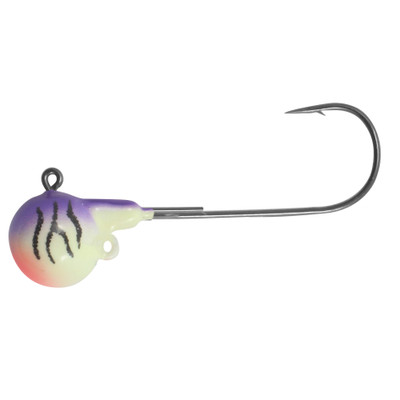
Water is 76.1°F, full summer, and today runs two programs. The headline is a perch spreader in the deep water off Catawba, 28-32 FOW, which is the money bite this time of year. The second is a weighted worm harness for walleye, worked the reef edges at first light (24-30 FOW) before the fish scatter. The constraint today is the clock, not the tackle. The morning is calm SW and the afternoon brings 80% storms, so cover water fast, find a perch school and park on it, and be off before the sky turns. If you troll walleye, do it early on the reef edges. Keep it close, the better walleye reefs are W/NW into the incoming weather.
Perch Spreader + Shiners — THE HEADLINE TODAY
Two-hook crappie/perch spreader, #4-6 hooks, fresh emerald shiners on the bottom. Drop straight down on any school you mark, lift a foot and hold. This is the late-August bite off Catawba: the newest community.walleye.com threads are perch (8/19-8/20), and the Catawba area is a classic perch spot with the season running mid-July through October. Fish the 28-32 ft deep flats NE of the island, and the deeper 20+ ft breaks off Mouse Island Reef at 1.2 nm as a closer option. Anchor and park on the school, do not troll through it. West Zone limit 30.
Worm Harness — THE WALLEYE PATTERN
Crawler harness, gold or chartreuse blade, fresh nightcrawler. The presentation the Port Clinton reports credit: drifted or cast in 18-26 FOW, worked 4-8 ft off the bottom, at F Can, Clinton Reef, and between Catawba and Marblehead. Pull it behind a 1-2 oz bottom bouncer or an in-line weight at 1.0-1.2 mph. Keepers 15-22″. Best worked on the reef edges at first light before the walleye scatter. For the deeper eastern water ODNR names (23-30 FOW, lures 15-30 ft down), add weight or a Jet Diver.
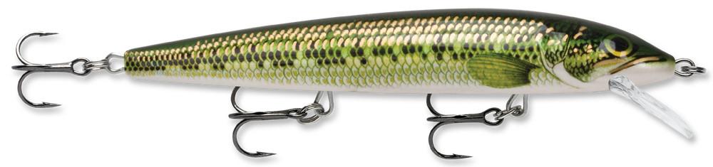
Husky Jerk HJ12
Rapala Husky Jerk #12. Short-line troll 30-50 ft back at 1.5-1.7 mph along the reef contour 18-22 FOW. The search bait: use it to find pods fast, then slow down and work them with a harness or a jig. Lean fast today — pre-frontal pressure means a fish more willing to chase, and covering water beats grinding when the clock is the constraint.
Off Shore OR12 In-Line Board — ON, AND DEPLOY EARLY
Off Shore Tackle OR12 Side Planer. One board each side pulls lines 15-30 ft out so you can run 3-4 rods without tangling. Right water is the open 23-30 FOW east of the reef complex, away from today's W/NW weather. The one caution today is timing: the wind builds through the afternoon toward tonight's NW 15-20 kt, and boards get harder to manage solo as it does, so put them out early or skip them. If you run them, start with ONE, get the release tension right, add the second once the first feels routine.
> TROLLING PROGRAM (PWC)
The whole game is putting baits at the right depth and speed and covering water until you find a pod, then working back through it slowly. Rig C, the weighted harness, is still the walleye headline. Today's twist is timing: fish the reef edges early for walleye and the deep flats for perch, and deploy any trolling spread before the afternoon wind builds.
THE NUMBERS
01
Speed: 1.5-1.8 mph on the GPS for crankbaits, dropping to 1.0-1.2 mph for a worm harness. Watch SOG, not the throttle — on a SW wind you will gain speed running downwind and lose it coming back. Try with the current and against it, which one works flips day to day.
02
Lead + depth: Reef Runner 800 / Husky Jerk #12 run ~6-12 ft down on 30-50 ft of line. The target water is 18-26 FOW and the reports say fish are 4-8 ft off the bottom, so that is 10-22 ft down. A crankbait alone will not reliably get there. Use a bottom bouncer, an in-line weight, or a Jet Diver to put the harness in that band. For the 23-30 FOW east of the reef complex, ODNR's number is 15-30 ft down, which is diver or bouncer water, full stop.
03
Where: the 23-30 FOW east of the reef complex, the Catawba-to-Marblehead corridor (which starts about 3 nm out, so you can work it close to home), F Can at Camp Perry, Clinton Reef, and the 19-28 ft reef edges out west. Work along the contour, not across it. Try with the current and against it, because which one works flips day to day.
THREE WAYS TO RIG IT (light SW wind — all three are on, but front-load the day)
A
Flatline / short-line: rods straight off the back, 2 lines, crankbaits 30-50 ft back. Simplest solo rig and the fastest way to find fish. Shake out on Mouse Island Reef before you spread wide, which doubles as your look at the water.
B
In-line planer boards (Off Shore OR12) — optional today: clip a board on each side to pull lines 15-30 ft out and run 3-4 without tangling. The calm SW morning is a solo-deployable window. Put them out in the
open 23-30 FOW east of the reef complex, away from the W/NW weather.
Be honest about the clock — the wind builds through the afternoon toward tonight's NW 15-20 kt, and boards get harder to handle solo as it climbs, so deploy early or skip them. If you have never run boards before, a storm-risk day is not the day to learn. Start with ONE board, get the release tension right, add the second once it feels routine.
C
Worm harness + bottom bouncer or Jet Diver — still the walleye pattern: pull a crawler harness (gold or chartreuse blade) behind a 1-2 oz bottom bouncer or Jet Diver to hold it
4-8 ft off the bottom in 18-26 FOW at 1.2-1.3 mph, or
15-30 ft down in the 23-30 FOW east of the reef complex. This is the presentation the Port Clinton reports credit for the 15-22″ keepers, and it works either drifted or cast, which suits the PWC. At 13.6 kt the natural drift will overrun 1.2-1.3 mph, so check SOG and slow it with the trolling motor.
MistakeTreating the western reefs as a normal option today. Niagara, Toussaint, and Little Pickerel are all fishable on this wind, and on any other day this brief would push you out there. Today the storm risk is late and the wind builds tonight, which makes a 9.5 nm leg the one decision that can turn a good morning into a bad afternoon. If you go west, go at 6:19 and be heading back by noon. (The standing mistake still applies: put weight on the harness. Fish are 4-8 ft off the bottom in 18-26 FOW, which is 10 to 22 ft down, and a plain flatline rides straight over the top of them.)
Full how-to: Worm harness · In-line boards · Short-line trolling
05Beginner Notes
- The clock is the fish today, not the lure. Your best water and your only safe window are the same thing this morning. Storms fire after ~3 PM and the wind clocks NW behind them. The honest plan is launch now, fish through early afternoon, and set a turnaround before you leave the ramp. Don't let a good perch school talk you into squeezing the afternoon. Be on the trailer before building cumulus turns into anything.
- Perch first, walleye as a bonus. At 76°F the perch bite off Catawba is the higher-percentage play than chasing scattered summer walleye. Find one school in the 28-32 ft deep flats and you can fill a cooler. Move if you don't mark fish in 10 minutes, perch are schooled and mobile. If walleye is the goal, be on a reef edge at first light before they scatter.
- One safety note: NW is your enemy today. The SW morning wind keeps Catawba's south shore calm, but the second it clocks NW and the chop starts stacking on the reefs, that's your signal to go, storm or not. File a float plan with Jen (where, when back), keep the kill-switch lanyard clipped to your PFD, PFD worn, phone in a dry bag, and remember Ohio's sunrise-to-sunset PWC rule. Hit REFRESH before committing to any long run. DDM coords only; the .GPX loads every waypoint to the ECHOMAP.
06Sources Pulled generated 7:45 AM ET 8/22 · conditions refresh live on the page
- NWS LEZ143 nearshore marine (Reno Beach to The Islands, pulled 7:40 AM ET 8/22): no Small Craft Advisory, no headline warning. Today SW 5-10 kt becoming west, waves 1 ft or less, a chance of showers with a slight chance of thunderstorms this morning, then showers and thunderstorms this afternoon. Tonight NW 10-15 kt increasing to 15-20 kt, showers and thunderstorms likely, waves 1-3 ft, waterspouts possible overnight. Sunday NW 15-20 kt becoming west, waves 2-4 ft subsiding to 1-3 ft, waterspouts possible.
- NWS Catawba/Marblehead point forecast + hazard banner (Ottawa County OHZ007, pulled 7:40 AM ET): no active hazard headlines (no dense fog advisory, no Special Weather Statement, no thunderstorm watch as of the morning read). Today mostly cloudy with gradual clearing, high 79°F, 80% showers and thunderstorms mainly after 3 PM with a quarter to half inch of rain. Tonight low 61°F, 60% storms likely before 2 AM.
- Buoy 45005 (NDBC, 7:10 AM ET obs): water 76.1°F, air 71.8°F, wind SE 11.7 kt (140°). WVHT not reporting this deployment (dashes), so the wave figure comes from LEZ143, not a buoy measurement.
- community.walleye.com Western Basin (index pulled 7:40 AM ET): freshest local index. Two newest threads are perch: "Perch" (8/20) and "Fishing with Rick and Donna" (8/19). Thread bodies were not retrievable this run (forum index only served), so used as a timing signal, not for specific coords.
- Regional Aug 2026 reports (web search: fishingbooker, charter reports): late July through August is prime yellow-perch season on the Western Basin, and the Catawba Island area is a named perch spot with catches into the 100s. Walleye good numbers, some moving east; deepwater reefs the summer holding water. West Zone daily limits: 6 walleye, 30 perch.
- lakeeriefish.com Western Basin subpage SKIPPED as STALE: served, but content is a spring report ("off to a slow start," "water still needs to warm up"). Not applicable at 76°F. Used only for the standing seasonal pattern (reef edges, 1-1.8 mph trolling on Reef Runners / Husky Jerks), not as this week's intel.
- Coe Vanna Charters / sirwalleyecharters / fishingbooker daily SKIPPED: most recent Western Basin entries stale (spring) or blocked (403). Coe Vanna's reef coordinate list remains the source for every [HIGH] waypoint in this brief.
- Lake Erie Walleye Trail: no recent Western Basin event surfaced.
- FB groups SKIPPED this run: the Playwright scraper's Chromium browser binary is not installed on the laptop (needs a one-time
playwright install). No FB scrape this run; all other sources current.
This is a refresher, not a class. Reread it the night before a trip. You're running a low-freeboard PWC on the shallowest, rockiest, most weather-volatile basin of the Great Lakes, sharing water with 700-foot freighters and weekend pontoon traffic. Three things will keep you alive and legal: respect the reefs, know who has right of way, and follow Ohio's PWC rules. Everything below is built around those three.
ALake Erie Western Basin: PWC operating envelope
The Western Basin is the shallowest part of Lake Erie. Average depth around 24 feet, with reef shelves at 1 to 4 feet that aren't always buoyed. Wind builds chop fast because there's nothing for waves to do but stack. A Fish Pro Trophy sits low. You feel weather sooner than a 22-foot center console does.
Rule of thumb: GO/NO-GO
Green light: winds under 10 kt, waves 1 foot or less, no T-storms in the 6-hour forecast.
Yellow light: winds 10 to 15 kt, waves 1 to 2 feet. Doable if you stay west of the islands and inside known water. Plan a short loop.
Red light: winds 15+ kt sustained, waves 2+ feet, or any T-storm risk. Stay on the trailer. The Western Basin builds 3 to 5 foot square chop fast, and a PWC takes those waves like a brick. NOAA marine forecast for LEZ143 is the call, not the lakeshore forecast.
Reef awareness
Niagara, Crib, Round, Gull Island Shoal, Locust Point, and the reef complex around the Bass Islands all have spots under 2 feet. Most are unmarked. A jet drive sucking sand and gravel will eat your wear ring and pump in one pass. Rule: stay in 4+ feet of water unless you have eyes on the bottom and a charted track. Use the Garmin chartplotter's depth shading. If you see color change in the water (lighter green or brown), throttle down and look before you commit.
Wind-driven water level
A steady 15+ kt SW wind can drop Western Basin water levels 1 to 2 feet in an hour (it sloshes east toward Buffalo). A reef that was 3 feet deep at launch can be 12 inches deep by lunch. If wind is steady SW, recheck depth on familiar spots before running shallow lines.
PRE-LAUNCH CHECKLIST (Catawba ramp)
01
Check NOAA marine forecast LEZ143 (Western Basin) the morning of, not the night before. Note wind direction, gust spread, wave height, T-storm timing.
02
File a float plan. Text Jen: launch ramp, intended area, expected return time. "Mouse Island to Niagara Reef, back by 2 PM."
03
Drain plug in. Check it every single time. PWCs don't have a hull drain plug like a boat, but the LinQ livewell cooler and any aftermarket mods might. Verify.
04
Gear check: PFD on, kill-switch lanyard clipped to PFD (not the handlebar), whistle, phone in dry bag, paddle, anchor with at least 50 ft of line, throwable Type IV cushion stowed, fire extinguisher in date.
05
Fuel: 1/3 out, 1/3 back, 1/3 reserve. The Fish Pro Trophy's range drops hard in chop.
06
Garmin on, depth alarm set to 4 ft. Confirm GPS lock before you leave the no-wake zone.
IF CONDITIONS DETERIORATE MID-TRIP
01
Decide early. The moment whitecaps appear or the forecast worsens, turn for the nearest safe harbor. Don't try to finish the last drift. Catawba, Put-in-Bay, Kelleys Island, and Port Clinton are all options. Pick the one with the shortest beam-sea exposure.
02
Quarter the waves, don't take them broadside. A PWC rolled by a beam sea will dump you. 30 to 45 degrees off the wave face is the sweet spot.
03
Slow down. Trying to outrun chop in a PWC ends with you launching off a wave and landing flat. Power down to where the hull stays in contact with water.
04
If you go in the water: kill-switch cuts the engine, ski circles back idling (Sea-Doo iBR + lanyard design). Approach from the rear, board from the reboarding step. Practice this once in calm water before you need it.
MistakeAnchoring bow-first in chop. The Fish Pro's bow eye is low, waves climb the hull, and you swamp the front storage. Anchor off a stern cleat with enough scope (7:1 in chop) so the ski rides up and over swells, not into them.
MistakeStanding rods in the gunwale holders while running over 15 mph. Tips whip, lines tangle into the intake grate, and a $200 rod becomes a $40 broken blank. Lay rods flat under bungees for transit, holders for trolling and drifting only.
MistakeForgetting the LinQ livewell pump strainer. It clogs with weeds and zebra mussel shells fast in Erie. Check and clear it before every trip or your walleye are dead by noon.
Fish Pro Trophy quirks
The Garmin 7″ with in-hull transducer reads great at trolling speed but gets noisy above 25 mph. Use Slow Mode (up to 8 mph) for sonar work. The 13.5 gal LinQ cooler/livewell quick-disconnects, take it off when you don't need it. Anchoring system (bow and stern cleats with the included rope retractors) is purpose-built, use it instead of clipping to a fishing rod holder. iDF (intelligent debris-free) pump on Trophy 170 helps with Erie's weed mats but doesn't make you invincible. Stay out of obvious weed lines at speed.
BUSCG navigation rules: right of way
The Navigation Rules (COLREGS and US Inland Rules) treat every encounter as one boat being the stand-on vessel (holds course and speed) and the other being the give-way vessel (alters course or speed to avoid). PWCs are power-driven vessels under the rules, so the same rules apply to you as to any motorboat. But you also have practical obligations because you're small, fast, and harder to see.
THE THREE ENCOUNTERS
01
Head-on: both vessels alter course to starboard (right) and pass port-to-port. One short blast signals "I'm altering to starboard." If both boats do this, you pass each other on the left side, like cars on a US road.
02
Crossing: the boat on your starboard (right) side is the stand-on vessel. You are give-way. Slow, turn behind them, or both. Think "if you see red on the right, give way." The other boat's red port light is on your starboard side, meaning you're crossing in front of them.
03
Overtaking: the overtaking vessel is always give-way, regardless of vessel type. If you're passing a slower fishing boat, you go around them. Pass on whichever side is safer and signal: one short blast to pass on their starboard, two short blasts to pass on their port.
PWC practical reality
Officially, a PWC has no special legal subordination — you're a power-driven vessel like everyone else. Practically, yield to everything. Sailboats, anglers on anchor, kayaks, pontoons, bass boats. They don't expect you, they can't maneuver as fast as you, and the courtroom doesn't care that you were technically the stand-on vessel if you T-boned a sailboat. PWC operators draw extra scrutiny. Eat the right of way, keep moving.
SOUND SIGNALS (USCG Inland Rules)
01
One short blast (1 sec): "I intend to leave you on my port side" (I'm turning to starboard / passing you on your starboard).
02
Two short blasts: "I intend to leave you on my starboard side" (I'm turning to port / passing you on your port).
03
Three short blasts: "I am operating astern propulsion" (backing up).
04
Five or more short blasts: DANGER or "I don't understand your intentions." If someone blows five at you, stop and figure out what's wrong. If you can't tell what another boat is doing, you blow five.
05
One prolonged blast (4 to 6 sec): sounded when leaving a dock, coming around a blind bend, or in restricted visibility. Required equipment on a PWC: a whistle or horn audible at half a mile. The pea whistle on your PFD counts in a pinch but a real horn is better.
Red right returning
When returning from sea (heading into port, upstream, or into Sandusky Bay / Port Clinton harbor from the open lake), keep red buoys on your right (starboard) and green on your left. Buoy shapes: red = nuns (pointed/conical top), green = cans (flat top). Lighted buoys: red flashes red, green flashes green. On Lake Erie, "returning" means heading toward shore or harbor from the open lake. If you're running west out of Catawba toward the open Western Basin, you're "heading to sea," so flip it: red on your left.
Commercial traffic
Lake Erie still moves freighters, mostly 600 to 1000 feet long, drawing 28+ feet. They run the shipping channels north of the islands and into Toledo, Sandusky, Cleveland, and Lorain. Stay out of their way. Always. They cannot stop, they cannot turn quickly, and they can't see you in the last quarter-mile in front of the bow. Cross shipping lanes at 90 degrees, behind the freighter, never in front. Their wake is a 4-foot rolling swell, hit it bow-on at slow speed and ride it out. A freighter's draft is deeper than most of the Western Basin, so they stay in well-marked channels. Know where the channels are (Pelee Passage, South Passage between Kelleys and Marblehead) and don't loiter in them.
Fishing vs underway
A boat actively fishing with gear that restricts maneuverability (commercial trawl, longline) is a "vessel engaged in fishing" with priority over power-driven vessels. Recreational anglers do NOT get this status. A guy trolling with downriggers is still a power-driven vessel under the rules. But common courtesy and common sense say: don't blast through someone's drift, don't cross close behind a trolling boat (you'll cut lines), and give anchored anglers a wide berth at no-wake speed.
MistakeAssuming a sailboat will keep clear because you're faster. Under sail alone, a sailboat is stand-on against any power-driven vessel (including you), and they often can't change course quickly. You give way. Period.
COhio PWC regulations (Ohio DNR Division of Parks & Watercraft)
Operator age
16 and older: can operate a PWC alone with a valid boater education certificate (if born on/after Jan 1, 1982).
12 to 15: can operate a PWC only with a Boater Education Certificate AND an adult (18+) physically on board.
Under 12: cannot operate a PWC, period. Can ride as passenger.
Boater education (NASBLA)
Ohio Revised Code 1547: anyone born on or after January 1, 1982 operating a powercraft greater than 10 HP must complete a NASBLA-approved boater education course or pass the Ohio Division of Watercraft proficiency exam. The Fish Pro Trophy is 170 HP, so this applies. The card never expires. You must produce it within 72 hours of being stopped by law enforcement. Take BoatUS Foundation's free Ohio course online if you haven't already.
Hours of operation
PWCs in Ohio may only be operated between sunrise and sunset. No dawn patrol, no dusk runs. Doesn't matter if your lights work. The law is the law. This eliminates the magic-hour walleye bite from a PWC. Plan accordingly.
PFD and kill switch
Every person on board a PWC must wear a USCG-approved Type I, II, III, or V PFD at all times while underway. Not stowed. Worn. The operator must also have the engine cut-off lanyard attached to person, PFD, or clothing (federal rule, applies on Ohio waters too). Clipping it to the handlebar defeats the purpose and is a violation.
Distance and speed rules
Operate at idle / no-wake speed within 300 feet of: shore, docks, swim areas, anchored or moored vessels, marinas, launch ramps. No wake jumping closer than 200 feet to another vessel. No weaving through congested traffic. No operating in a manner that endangers life or property. Ohio doesn't have a single "X feet from shore" speed line statewide, but the 300 ft no-wake bubble around fixed structures is the operative rule.
Registration and decals
Every PWC in Ohio must be titled and registered through the Ohio Division of Parks & Watercraft. Registration is valid 3 years. Registration number (OH-XXXX-XX) must be displayed on both sides of the bow in 3″ block contrasting letters with a hyphen or space between groups. Current validation decal goes within 6 inches of the registration number. Keep the registration certificate on board (laminate it, dry bag it).
Required equipment checklist
USCG-approved PFD per person (worn). Engine cut-off lanyard attached to operator. Sound-producing device (whistle or horn, audible 1/2 mile). USCG-approved Type B-I fire extinguisher (current, unexpired). Visual distress signals are not required on inland Lake Erie waters during daytime, but a handheld VHF (Channel 16) is strongly recommended for the Western Basin. Registration certificate. Boater education card.
MistakeSkipping the kill-switch lanyard because "I'll only be on it 10 minutes." If you eject and the ski doesn't shut down, it goes full throttle in a circle and people die. ODNR cites for this. Clip it to your PFD strap every ride.
MistakeCarrying an expired fire extinguisher. The Type B-I has a service life and a pressure gauge. ODNR and USCG Aux check this on safety stops. A $20 replacement avoids a citation and an awkward conversation.
DTrip-day mental checklist
Read this in the truck before backing down the ramp.
01
Forecast still green? NOAA LEZ143 in the last hour, not last night. Wind direction, gusts, T-storm timing, wave height.
02
Float plan sent? Where, when back, who to call if I don't check in.
03
PFD on, lanyard clipped to me, whistle on the PFD.
04
Phone in dry bag, VHF on Channel 16 if I'm carrying one.
05
Garmin showing depth, depth alarm at 4 ft, charted course set.
06
Reef avoidance plan: which reefs am I fishing on top of vs running around? Know the difference before I leave the ramp.
07
Out-of-fuel/weather bail-out: nearest harbor from the spot I'm fishing. (Catawba, Put-in-Bay, Kelleys, Port Clinton.)
Sources
Ohio Revised Code Ch. 1547. Ohio DNR Division of Parks & Watercraft Boat Operator's Guide. USCG Navigation Rules (33 CFR / COLREGS). BoatUS Foundation Ohio Course. NOAA Marine Forecast Zone LEZ143 (Western Basin nearshore). NOAA Coast Pilot 6, Ch. 6 (Lake Erie). Sea-Doo Fish Pro Trophy owner's manual / BRP spec sheet.